
Geology / Rocks
Where is the nearest outcrop of Silurian rocks? This page shows where rocks of approximate Silurian Age can be found.
There are four maps of the world centered on Longitude: 0°, 90°, 180° and 270°
Areas of surface rock (or covered by a small thickness of recent 'drift' deposits) dating from the Lower Paleozoic are shown with a brown color. The Lower Palaeozoic covers the time period 570 to 405 Million years ago (Cambrian, Ordovician and Silurian systems). The Silurian represents the youngest 30 million years of this period and so the actual area of rock dating to the Silurian is much smaller than shown (approx. 20 % of the area shown).
Longitude 270°
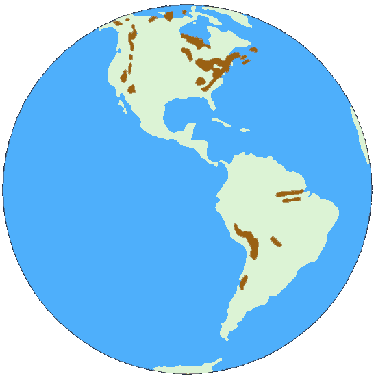
The Americas do not have substantial rocks of Silurian age. Areas of outcrop follow the main mountain ranges (Rockies, Andes and Appalachians). Considerable areas of Silurian rocks in Newfoundland and Canada are present. This represents the Eastern edge of the Iapetus Ocean that was closing up during the Silurian. The Niagra falls are the most famous rock of Silurian age.
Back to top
Longitude 0°
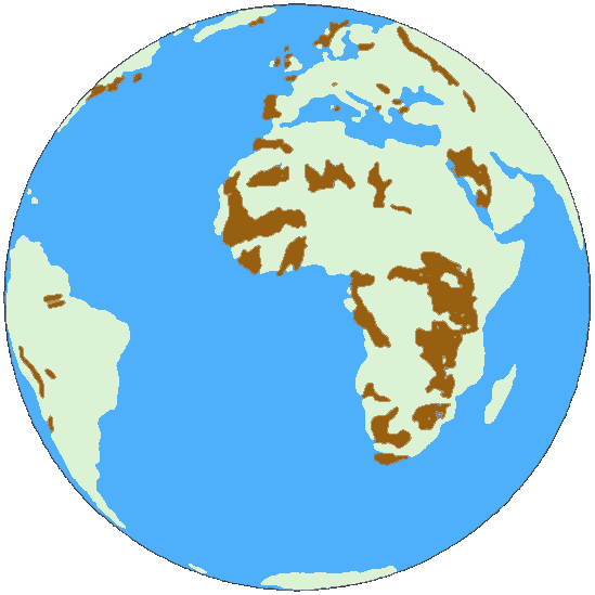
The main outcrops in Europe follow the line of the ancient mountain range (Caledonides) formed when the Iapetus Ocean closed. Although substantial areas are shown in Africa, some of this includes rocks of PreCambrian age as well as Lower Palaeozoic. There are still vast areas awaiting detailed mapping in Africa.
Back to top
Longitude 90°
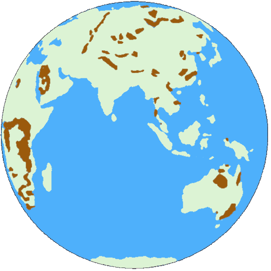
Silurian outcrops in Asia are scattered except for the linear feature that follows the Ural Mountains. China in Silurian times was split into several isolated plates and the complex geology of China and Central Asia account for the patchy distribution.
Back to top
Longitude 180°
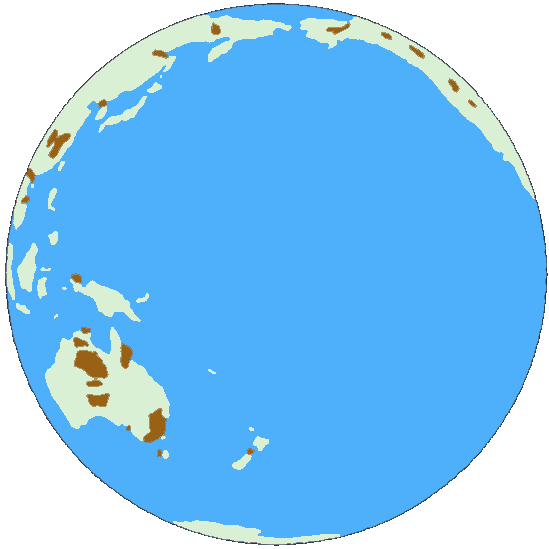
The last map shows the distribution in Australia and the Pacific Rim. As there is not much land in view the significant outcrops on Australia are prominent.
Back to top