Geology / Maps
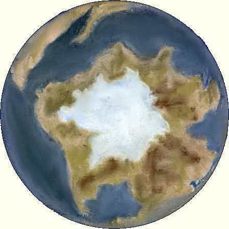
The South Pole : 420 Million Years ago
Much of the continental crustal area was located near to the South Pole in Silurian times. At the end of the Ordovician glaciation a much reduced ice cap covered the main area of land.
At a two o'clock direction from the center are the rocks that will form present day Italy and Greece, at this time still clearly belonging to the African plate. At a five o'clock direction the present day Eastern coast of Africa is still joined to Madagascar, India and Antarctica. This plate broke away from Gondwana about 170 Myears ago.
On the edge of the view at a three o'clock direction is a fragment of Asia destined to form present day Mongolia.
While at a 10 o'clock direction (NW) the North American plate is about to be joined by an area of land forming present day Newfoundland, England and Spain.